
You’ll find that this post comes worded quite differently as no one can quite word things like my dad could. He had a knack for storytelling and loved to add in his photography skills as he shared. He loved many things, really. Photography, storytelling, storm chasing, voicing his opinions on
Tulsa’s mayor G.T. Bynum posted this on X. Please read the entire article to get your questions answered about Tulsa being or becoming a sanctuary city. I generally don’t waste time responding to ridiculous garbage being circulated around town, but it has begun to distract from important progress we are

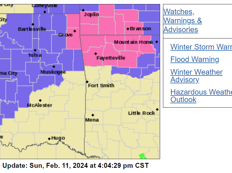
2/11/2024, 4:00pm update The forecast area and forecast have been updated. Up to 4″ of now accumulation is possible in the Tulsa area. URGENT – WINTER WEATHER MESSAGE National Weather Service Tulsa OK 1253 PM CST Sun Feb 11 2024 OKZ054>057-059>062-064>071-121100- /O.CON.KTSA.WW.Y.0007.240212T0300Z-240212T1800Z/ Osage-Washington OK-Nowata-Craig-Pawnee-Tulsa-Rogers-Mayes-Creek- Okfuskee-Okmulgee-Wagoner-Cherokee-Adair-Muskogee-McIntosh- Including the cities of Pawhuska,
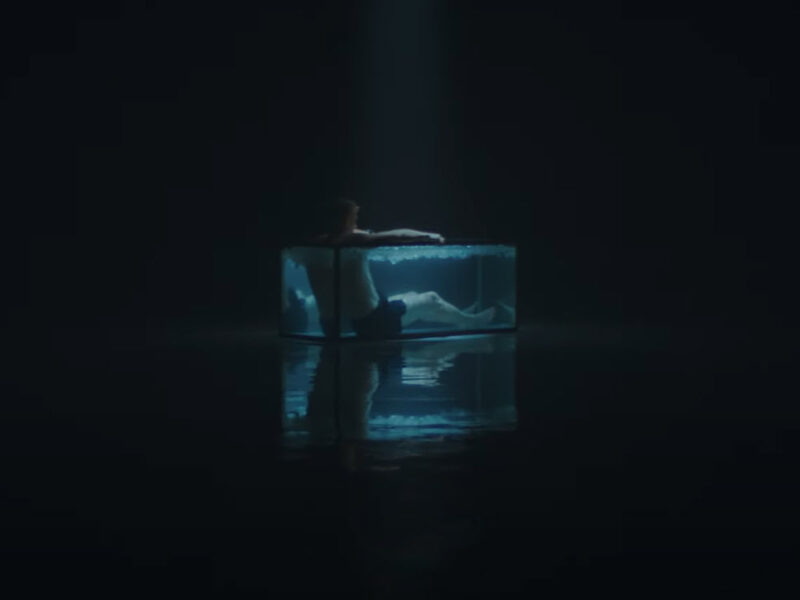
After months of private showings, the YouTube channel Yes Theory has made their award-winning documentary, “Project Iceman”, available to everyone. I was fortunate enough to see it a while ago and walked away from viewing it with total respect for the team they assembled to make it possible. They are

Good morning! I hope you all had a good Thanksgiving with your family and friends and a great weekend. I spent Thanksgiving with my brother’s family. It was nice to spend some time with everyone. It was also nice having a long weekend, even though I was a little under
A new terrorism bulletin has been released by the DHS and it’s in effect until November of 2024. I’ve posted the entire bulletin in this post.
I’m sittin’ here having my morning coffee. Daylight savings time ended overnight. I’m hoping this will be the last time the time changes. Your thoughts? I have nothing major planned for today, other than the normal to-do list around the house. You know, laundry, groceries, etc. I started the laundry
Good evening, friends. I hope this finds all of you well and warm. It’s been raining this weekend, and the temperature is dropping. It’s 5pm and only 37 degrees. Low tonight is expected to be below freezing and a Freeze Warning has been issued for most of eastern Oklahoma. It’s