
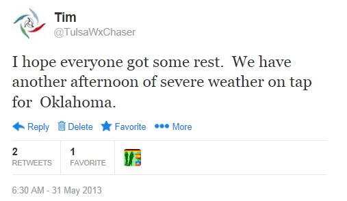
Like I do most mornings during the spring, I looked at the forecasts, weather data and models. I was more aware this morning because of the storms that raced through Oklahoma on Thursday. I sent this tweet at 6:30 AM. Little did I know.
I had been reviewing the set-up and potential areas off-and-on through the morning and it looked as though something was going to happen and, as usual, the OKC area was target area. I checked Spotter Network and storm chasers from around the country were getting into position.
I’d shown my co-workers an image with the locations of the dozens of chasers already lining up near OKC. “See this? Someone’s gonna get killed one of these days.” I’ve learned over the years to avoid the traffic jams that have become commonplace when chasing on high risk storm days – for good reason.
Severe storms were developing in the Oklahoma City area, but they were also developing northwest of Tulsa. Since I was getting a late start, I decided to avoid the worsening gridlock around OKC. My target area was Osage County.
I left Tulsa later than I’d planned, but that wouldn’t be a major problem. I wasn’t going to have to travel far or wait long for something to develop.
A line of storms stretching from southwest Oklahoma into southeast Kansas had developed and the whole line was moving to the northeast. As I drove to the north, the weather radio announced tornado warnings the area. One of the tornado warned storms was moving my way.
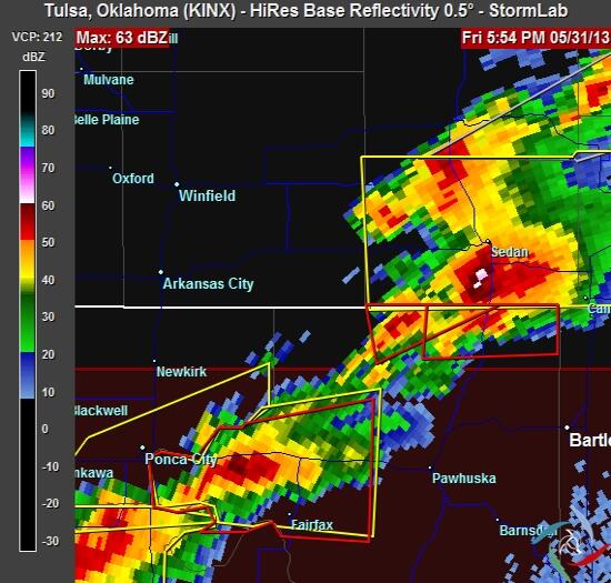
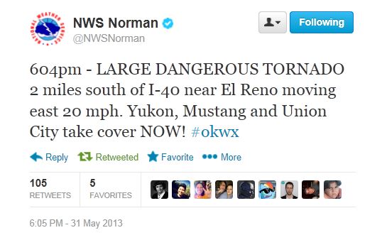
The National Weather Service issued several severe thunderstorm and tornado warnings for storm cells along the line, including a strongly worded tornado warning for a storm near El Reno.
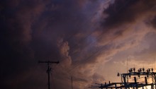
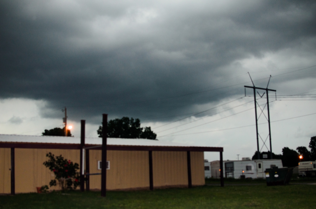
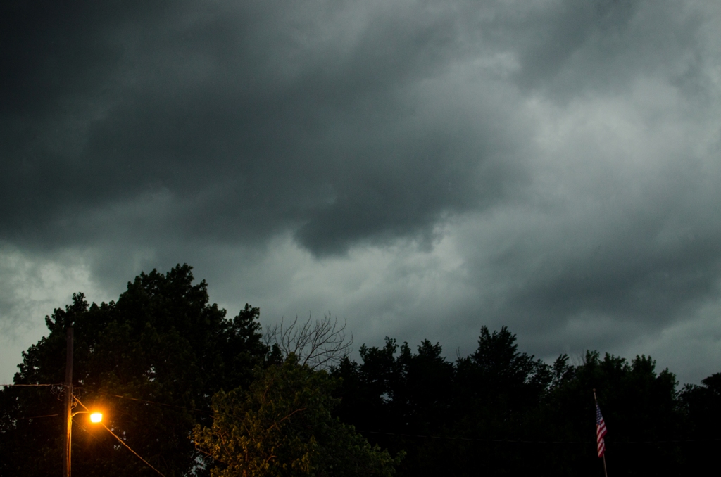
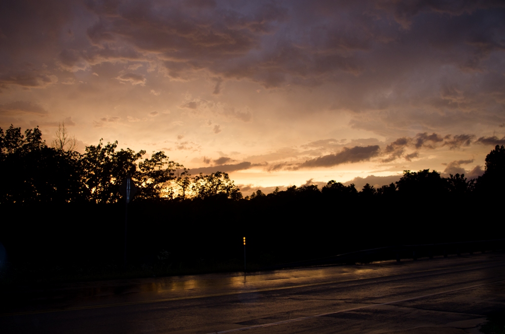
I continued towards the warned storms in my area. Just before eight o’clock I pulled off of highway 412, northwest of Sand Springs, and found a less-traveled road to safely view them. The skies were darkening and I could see the leading edge of one cell. It was ominous looking.
I watched the storm approach and then move past me. I decided to chase it further into Osage County.
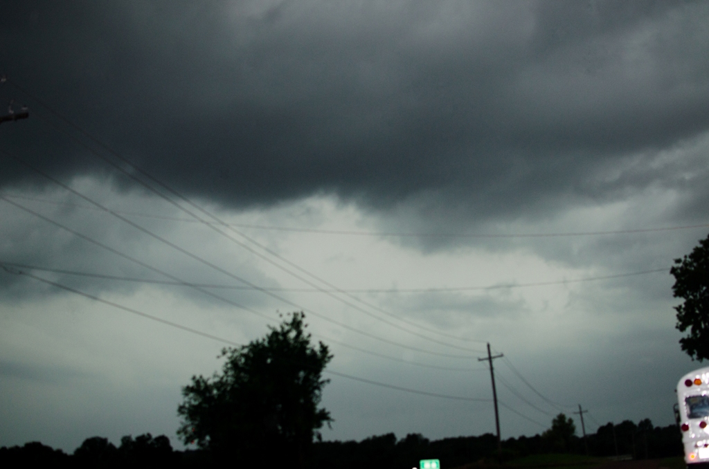
The storm was weakening and the sun was beginning to set. I knew I didn’t have much time left and would have to call an end to the chase soon. I pulled into a roadside parking area in time to be awed by the setting sun and remaining sunlight filtering through remnants of the storm.
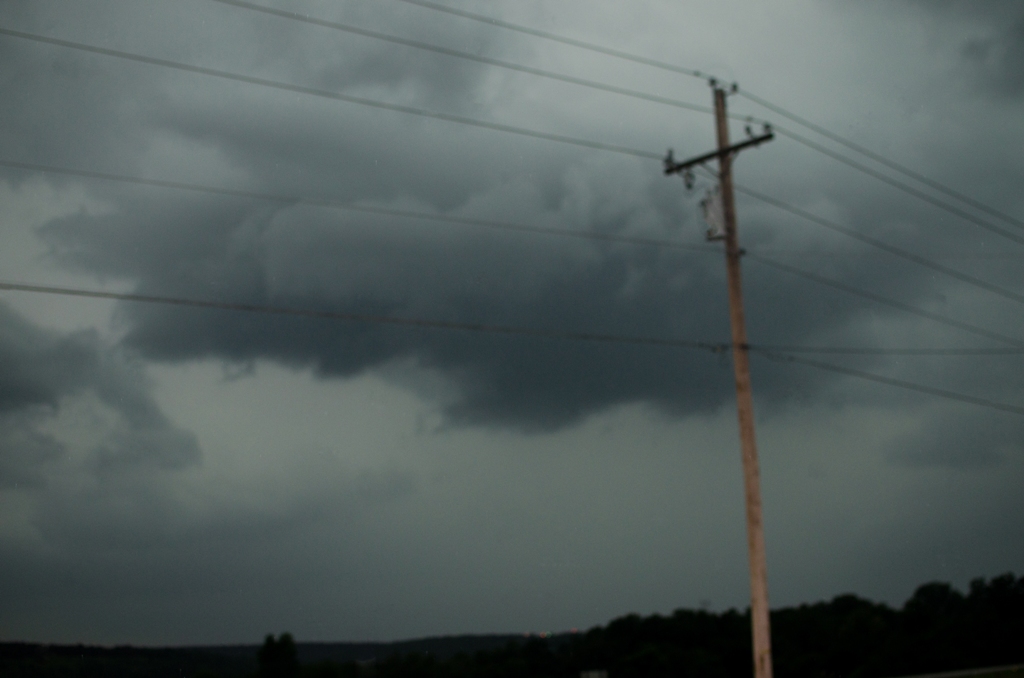
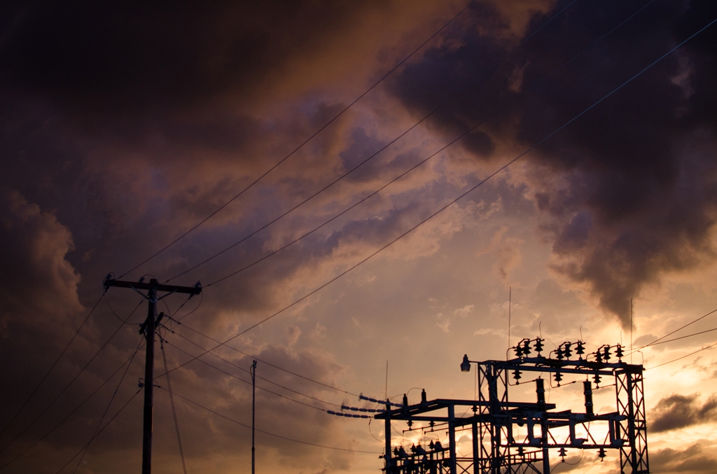
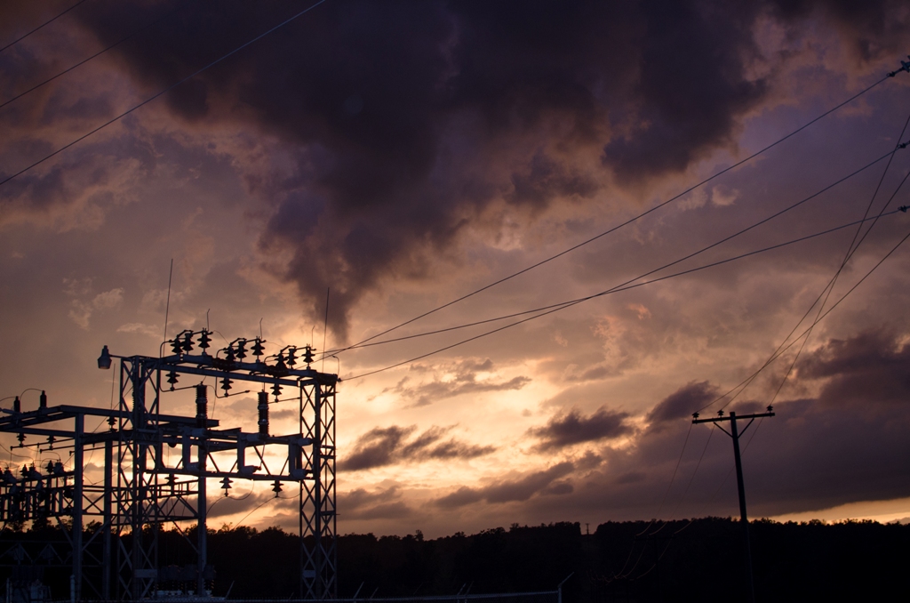
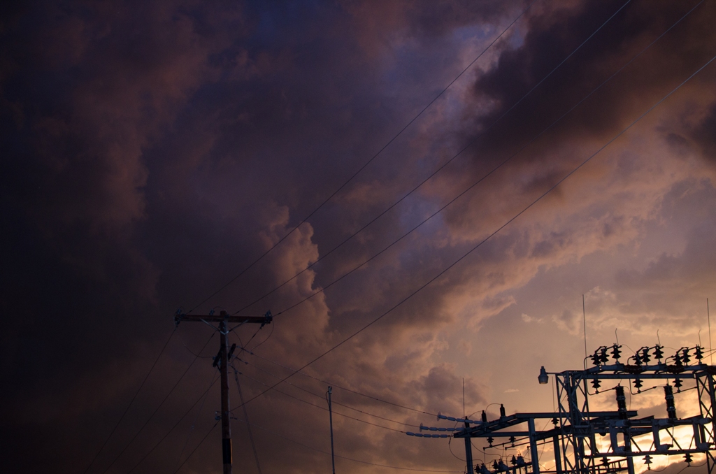
I drove a few more miles north and captured the final moments of the sunset near a power substation. Even the cold steel and wires carrying life to households nearby had been magically transformed into art – a silhouette against the sky. The entire scene would quickly succumb to the darkness and disappear into the night.
The chase was over.
As I drove back to Tulsa, the El Reno damage reports were beginning to come in. Descriptions of widespread damage and injuries. All of them were much-too-early assessments of what had taken place earlier.
I arrived back home at ten o’clock. What seemed to be the end of a wonderful day, soon tuned tragic.
The first confirmed information I received was about Weather Channel meteorologist Mike Bettes. His vehicle was hit by the tornado and Mike was injured. Fortunately no one was killed.
All of the other reports I had were preliminary, and I could wait to dig into them.
After unwinding for a bit and grabbing a snack, I went to sleep.
On Saturday, most of the conversation on social media and within the chasing community revolved around TWC “Tornado Hunt” chase team’s disregard for safety. I tend to agree. It seems as though some chasers get more aggressive each season. Safety boundaries are being tested to get an image or live stream severe weather. This time this team paid the price. They wouldn’t be the only ones.
The National Weather Service reported as many as five tornadoes touched down in the Oklahoma City area on Friday. The tornadoes were followed by torrential rains and flash flooding. The damage path would be massive. The number of injured were still being counted and fatalities were likely.
It wasn’t until Sunday that I learned that the Twistex chase team, headed by researcher Tim Samaras, was also hit by the El Reno tornado. This time it ended in tragedy. Tim Samaras, his son Paul, and Carl Young were all killed. Their location and the path of the tornado were all studied and the preliminary finding is the tornado changed course and Tim’s team didn’t have time to get out its path.
I’m convinced this day will be in the minds of chasers for years to come. Every time we chase. Every time we head into a storm. Hopefully we’ve learned something.