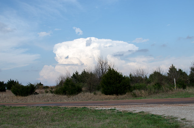
10:11 pm – I traveled a little over 300 miles chasing 3 storms. None of the three really produced much, but it was nice to get out and into nature.
I started in Coffeyville, chasing 2 cells into Parsons. Then back south and west for several miles to meet up with the 3rd storm – the one I really thought would produce.
It didn’t.
Then south through Osage county. Nice drive, crappy cellular connection.
I’m not too disappointed, though. It’s still early in the season.
Next time.
I did shoot a few pictures along the way. To view the photo album, click here.

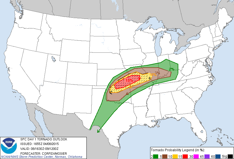
12:00 pm – We’re now looking at a moderate risk for tornadoes. I’m loading gear.
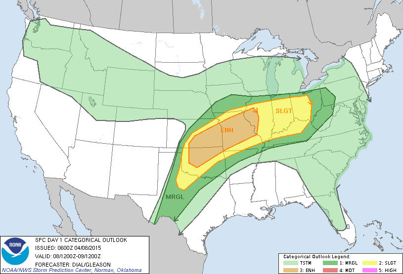
6:24 am – I’ve been looking at the forecast and models for today and there’s an “Enhanced” risk of storms today…onset is likely this afternoon. The potential for storms will continue through the night into the morning hours.
Currently the front is on the Kansas/Oklahoma state line and the dry line is in far west Oklahoma. But, those positions will change through the day. And, with highs today in the mid 80s and dew points in the mid 60s, the potential for severe storms is pretty high. However, some capping could inhibit storm development.
I think the key factor will be the dryline. Dryline positioning in relation to the front and improved low level jet stream will be the factors to watch. If those come together, the potential for tornadic supercells will increase.
Overall, this is worth keeping an eye on through today as the forecasts are updated.