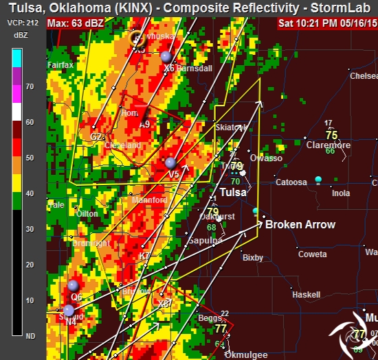
11:30 PM
Tornado Warning for Tulsa was canceled. Storm moved a little further east. I dodged that bullet.
___
11:21 PM
Tornado Warning for east central Tulsa county. My house. Heavy rain, small hail and lots of wind, so far. Lost radar connection.
___
10:28 PM
A line of severe storms moving into the Tulsa area. Risks are heavy rains, hail and damaging winds. Tornadoes are also possible.
___
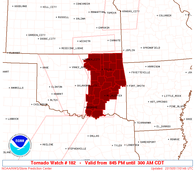
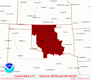
8:47 PM
Tornado Watch #182 has been issued for much of eastern Oklahoma, in effect until 3:00 a.m. This watch includes Tulsa.
___
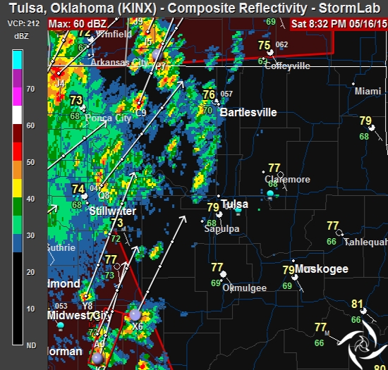
8:33 PM
A line of storms is finally moving into the Tulsa area. The most severe, at this point, still in SW and SC Oklahoma, slowly moving to the east-northeast. I’m watching it on radar, but doubt I’ll go out. Solo chasing at night is a dangerous adventure.
___
4:39 PM
Storms are just now beginning to develop way out west. This is going to turn into an “after dark” thing. I’ve made the decision to stay in Tulsa. Not quite the way I’d planned this thing. I’m wondering now if the NWS over-played the set-up.
The Tornado Watch areas have increased in the past couple of hours, in effect until midnight. Doesn’t include Tulsa. However, the forecasts are still indicating the area will move east as we progress through the evening.
Maybe I’ll chase down some dinner.
___
2:15 PM
Nothing much has changed. The area identified this morning is still the area now. I’m waiting for the next update that should come out about 3:00.
A tornado watch was issued for the Texas panhandle and the far west counties in Oklahoma. I’m not driving that far today.
I’ll know more when the update comes out.
___
8:05 AM
The outlook hasn’t changed much since earlier this morning, but the wording is a little stronger.
A WIDESPREAD THREAT OF SEVERE THUNDERSTORMS IS EXPECTED ACROSS THE
PLAINS STATES TODAY THROUGH TONIGHT...FROM PARTS OF NEBRASKA
SOUTHWARD TO TEXAS.  RISKS WILL INCLUDE VERY LARGE HAIL...DAMAGING
WIND GUSTS...AND SEVERAL TORNADOES -- WITH A FEW STRONG/LONG-LIVED
TORNADOES POSSIBLE.
Beginning in far western Oklahoma, the timing for storm development will be early afternoon. Closer to 4PM for central Oklahoma. I’ll pinpoint the area before I head out.
___
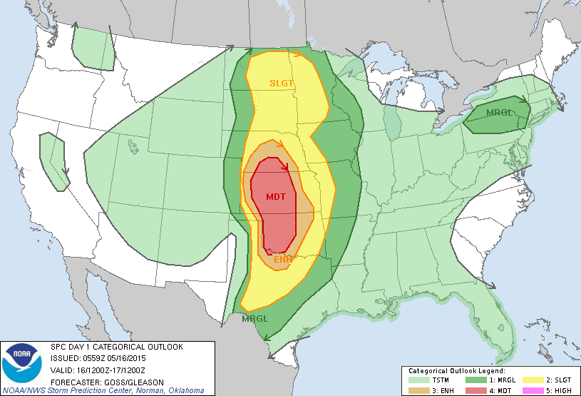
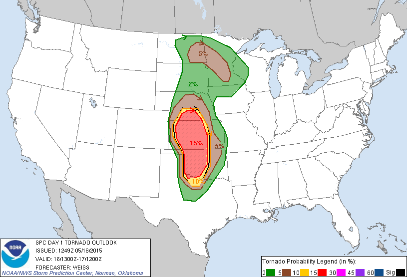
1:40 AM
The SPC has released the outlook and a large portion of central/western Oklahoma and Kansas has been carved out for a moderate risk of severe weather today.
HIGHLY SUGGESTIVE OF POTENTIAL FOR A SEVERE WEATHER OUTBREAK.
It looks like we could be hitting the road later today. I’ll get some sleep then check it again in a few hours.