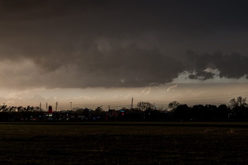
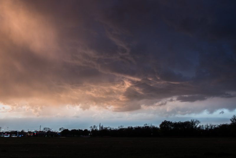
3/29/17 update:
Here’s a couple of the photographs from the day.
8:44 pm update:
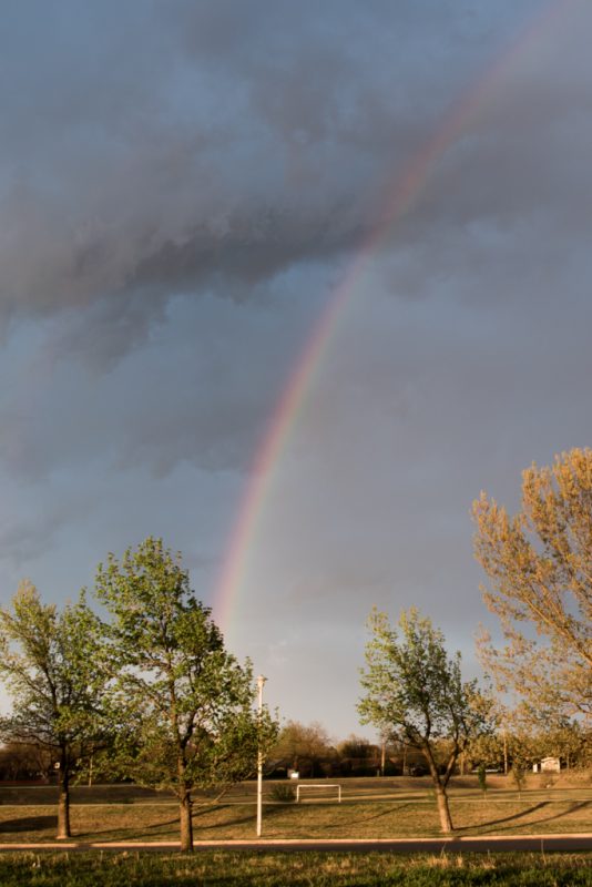
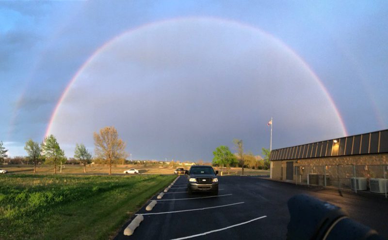
Just got back home. Most of the storms moved to the south of Tulsa. I got rained on a little, but nothing significant. I did get a couple shots at sunset and I’ll post those once I get them processed. I did get an iPhone picture of a double rainbow in east Tulsa. Even with the wide lense for the Nikon, I had to shoot panoramic on my phone to get the whole thing.
More storms are forecast to come through, but, now that the sun has set, I’m staying home. It felt good to get out.
6:39 pm update:
The storms are getting closer to Tulsa. I’m going to head out soon.
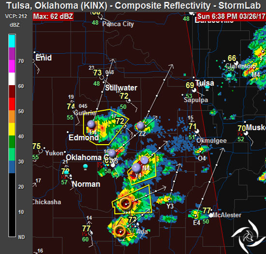
5:15 pm update:
I took a run south and the first line of storms produced little. Rain and lightning. It looks like we’ll have a late evening event. The cells developing south of OKC are more supercell-ish.
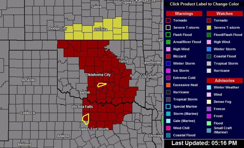
A tornado watch has been issued for a large portion of Oklahoma, to the west and south of Tulsa. This could be expanded as we progress through the evening hours.
3:53 pm update:
There’s a line of storms to the west of Tulsa moving this way. Nothing major though. Beginning to think I should have went southwest today.
2:25 pm update:
I serviced the truck and had lunch. Now to make some plans.
Not much has changed, forecast wise, since this morning. We’re still expecting severe storms to develop late afternoon into the evening. I’m not going to go far today. Maybe to the southwest of Tulsa. Nothing of note on radar right now, other than more chasers hitting the road. Showers are popping up near OKC and those are expected to intensify over the next several hours.
It’s a waiting game.
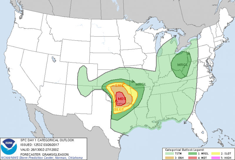
9:00 am:
Good morning!
Late afternoon storms are likely in Oklahoma. This morning’s SPC graphic shows a moderate risk for south central Oklahoma and an enhanced risk for the Tulsa area. Initiation will be around the I-35 corridor and then the system will move to the east through the evening. Threats associated with these storms will be heavy rain, winds, very large hail and tornadoes.
One major difference between today’s setup and yesterday’s is this system should produce some isolated supercells. The goal is to find them, and stay clear of a thousand other chasers. It’s a weekend and the first real chase day of 2017. Every chaser in Oklahoma will be out there.
Make sure you are ready, too. At a MINIMUM you need to:
- Get your shelter-in-place area prepared
- Put fresh batteries in your am/fm radio and weather radio
- Have at least a 3 day supply of food, water and medication on hand (don’t forget your pets)
- Charge your mobile devices (phone and laptop)
- Monitor your local radio and television stations for the latest information
The early morning models are likely to change over the next several hours, so I’ll be watching it closely as I get the gear together. But, don’t be complacent. This is a good opportunity to make sure you’re ready for the season. You have a few hours to prepare.