10:52 PM The severe storms have moved out of the Tulsa area, so I’m going to call it a night. I hope you’ve all survived the severe weather threat for today. Another round of severe weather is possible tomorrow.
Sleep well.
10:24 PM The Severe thunderstorm warning has been extended until 11:00 pm.
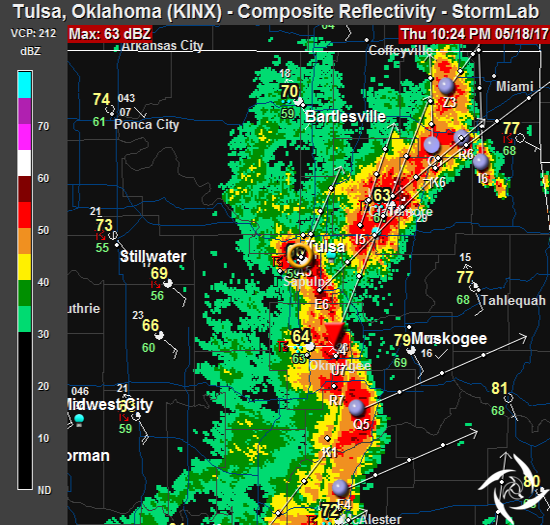
9:53 PM I thought I’d run out for Pepsi. Didn’t time it well. Drenching rain hit me as I ran to the car. I need to plan these things better. Severe thunderstorm warning was extended until 10:15 and it’ll, most likely, be extended again. Fun evening.
6,584 customers in Tulsa are without power now.
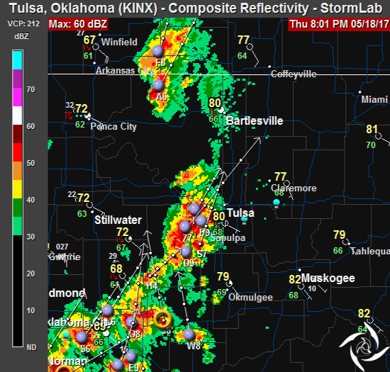
8:50 PM The first storm cells are in Tulsa. The next round is coming up right behind them. Severe Thunderstorm warning until 9:30 pm.
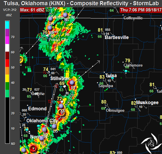
7:11 PM Storms continue to move into the area.
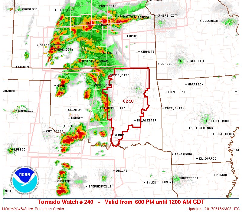
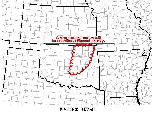
6:05 PM A tornado watch has been issued for much of NE Oklahoma. This watch is in effect until midnight.

5:54 PM A tornado watch could be issued soon. Stay weather aware.
5:15 PM Update: I looked at heading west, but the chaser convergence, with this being the first major outbreak, is too much.
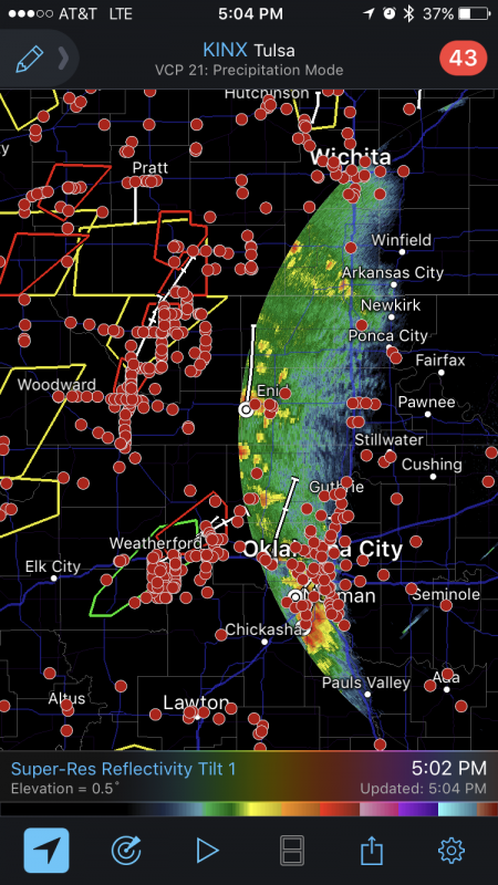
The red dots are registered storm chasers with their GPS tracking on. This doesn’t show those who aren’t registered.
I’m going to stay in Tulsa. Timing is still going to be after 7pm for our area.
12:23 PM Update: Not much of change. Still a good chance we’ll see severe weather today. Will likely move into the Tulsa area late afternoon/early evening.
Stay weather aware.
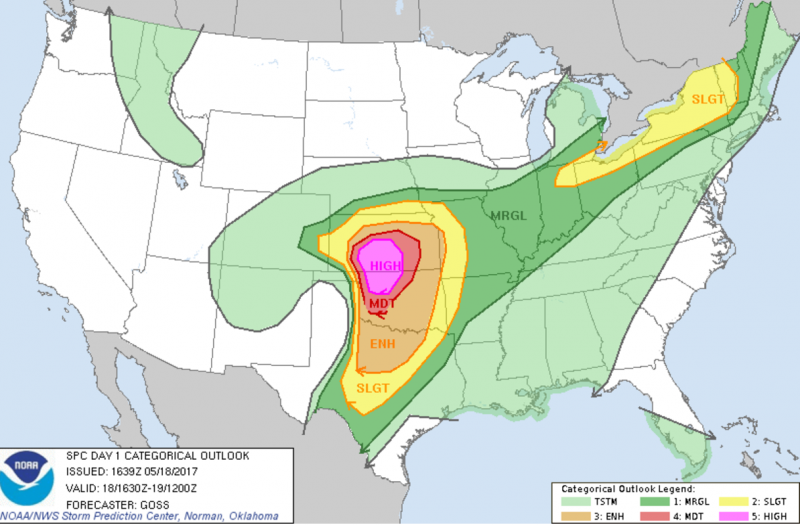
If you’re in Oklahoma or Kansas today, or travelling through either state, you need to remain weather aware due to a significant risk of severe storms. I’ll know more after the noon models are released, but for now you have time to check weather radios and flashlights, and preparing your shelter-in-place area for potential storms.
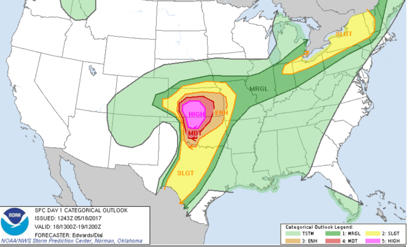
Here’s the current SPC outlook for today.