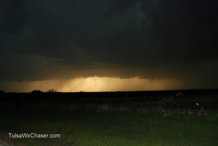
Today we chased some storms that proved to be powerful, although not really tornado producers. But, if your thing is heavy rain, small hail, gusty winds, and C-G lightning, this was your storm.
We started our early evening chase just east of Perry, OK. A possible tornado was being tracked in the Perry area. We didn’t have time to get to Perry, so we settled on watching the east side of the storm cell.
This was the only storm we were able to shoot photographs of, since darkness fell on us quickly.

We followed this storm into Stillwater.
Storms were beginning to develop back in the Tulsa area. We met up with those in Sand Springs and followed them into Tulsa.
Cold front fired storms are difficult to predict. I mean, this time of year storms will usually fire along the front, but how they react and what they end up producing is always a guessing game. I may be off base here, but normally tornado producing storms will be fed by the warm front and move (typically) in a northeasterly direction. These storms were fed by the cold front and moved to the southeast. Maybe that should have been our sign.
I’m still waiting for a good tripple point chase. You know when the cold front, the warm moist air and the dryline meet? In Oklahoma, you can’t miss with that setup.
Well, the tornado season is still young. There will be a few other storms to chase before we stow our gear. And, hopefully, you’ll continue to join us.
