
We have yet another moderate risk day. Beginning late this afternoon, we could see heavy rain, hail, strong winds and tornadoes. The Weather Channel is giving eastern Oklahoma a torcon rating of 6/10.
If this thing holds together, we’ll be looking back to yesterday as just a preview of coming events.
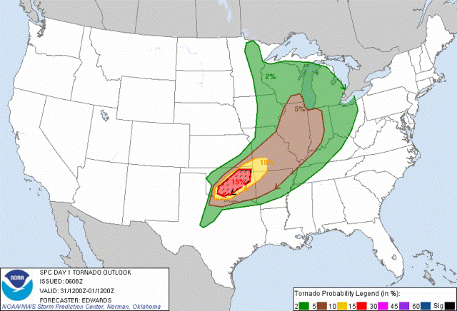
The NWS graphic shows the area of greatest tornado risk.
Don’t let your guard down yet. There’s more to come.