
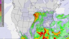
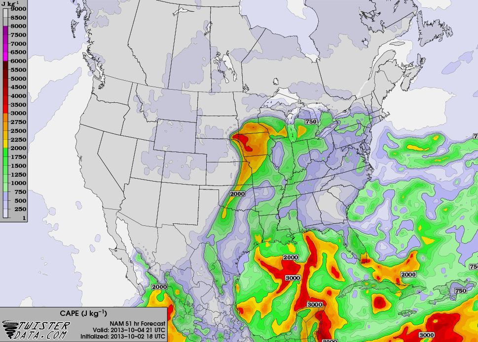
I’ve been looking at the models and we’re in store for at least more rain and we could see some severe weather. Right now the models are indicating the possibility of tornado development in western Iowa and southeast South Dakota. However, there’s a chance the storm system could brush eastern Nebraska and eastern Kansas. It’s a little too far for me to chase right now, but it’s worth watching.
In eastern Oklahoma, rain will be the major event, but thunderstorm development isn’t out of the question. Storm initiation will be late afternoon into the evening on Friday and will continue overnight into Saturday. Locally we could gain around 1/2″ of precipitation.
The system will be bring a cold front through the area, dropping Saturday’s daytime highs into the 50s. The low on Sunday could be in the mid 40s.
We’re still a couple days away, so the forecasts will likely change. I’ll post an update when things firm up.