4:17 am – Time for bed. Thanks for following along.
4:13 am – Temperatures are dropping some as the front moves through.
3:43 am – A severe thunderstorm watch remains in effect until 6 am for Delaware county in Oklahoma.
3:26 am – The severe thunderstorm watch issued for Craig, Nowata and Ottawa, has been canceled. The severe weather threat for tonight (this morning) is moving to the east.
2:48 am – Tornado Warning issued for Ottawa, Craig and Delaware counties in NE OK. Tornado reported at Quapaw.
1:52 am – Had to take a break and get something to eat. This has been a pretty wild night.
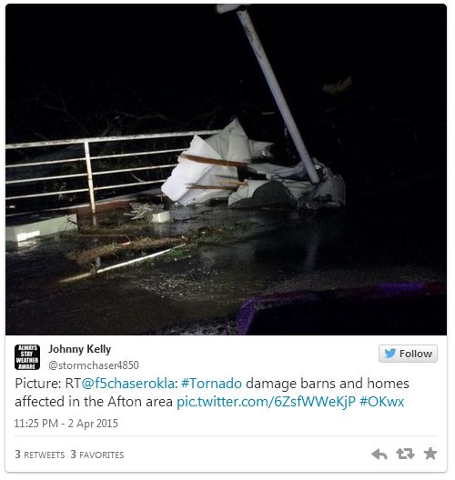
11:25 pm – Damage reports coming in from the Afton area. It’ll be after daybreak before a true assessment of the damage can be made.
10:44 pm – The storms have weakened some and the tornado warning has been allowed to expire. The threat for heavy rains, gusty winds and hail still exists in NE Oklahoma.
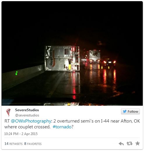
10:35 pm – 2 semi trucks overturned near Afton.
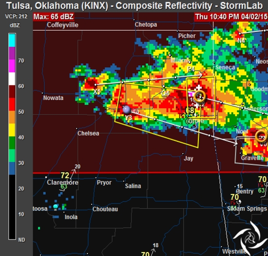
10:12 pm – Tornado Warning in effect until 10:45 for Craig, Delaware and Ottawa Counties.
“AT 1004 PM CDT…A SEVERE THUNDERSTORM WITH STRONG LOW LEVEL ROTATION
THAT COULD PRODUCE AN EXTREMELY DANGEROUS TORNADO WAS LOCATED NEAR
AFTON…AND MOVING EAST AT 30 MPH.
THIS IS A PARTICULARLY DANGEROUS SITUATION.
HAZARD…DAMAGING TORNADO.
IMPACT…YOU ARE IN A LIFE THREATENING SITUATION. FLYING DEBRIS WILL
BE DEADLY TO THOSE CAUGHT WITHOUT SHELTER. MOBILE HOMES WILL
BE DESTROYED. CONSIDERABLE DAMAGE TO HOMES…BUSINESSES AND
VEHICLES IS LIKELY AND COMPLETE DESTRUCTION POSSIBLE.
LOCATIONS IN OR NEAR THE PATH INCLUDE…AFTON…BERNICE…FAIRLAND…
BERNICE STATE PARK…WYANDOTTE…HONEY CREEK STATE PARK AND GROVE”
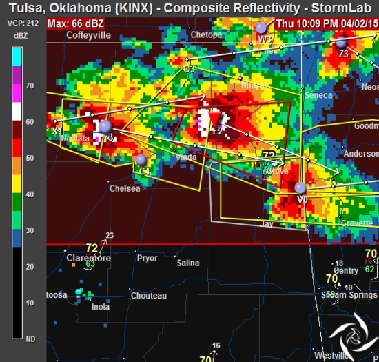
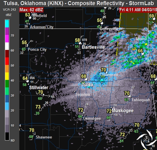
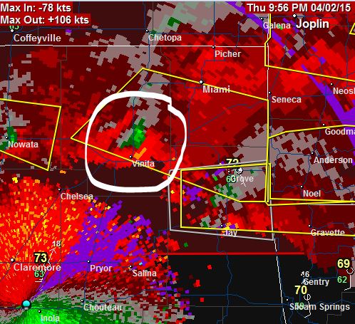
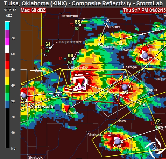
10:02 pm – Storms continue on path to Grove. Storm relative velocity clearly shows location of radar indicated rotation and and a Tornado Vortex Signature (TVS).
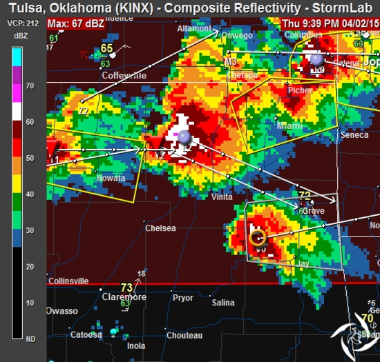
9:47 pm – Two huge storm cells moving towards Grove. Dig a hole. Get in it.
9:22 pm – Tornado Warning issued for Craig and Nowata counties, in effect until 9:45. I wish this had all happened earlier…during daylight.
9:14 pm – Severe Thunderstorm Warnings continue in NE Oklahoma. Tulsa not included. Watch box finally showed up.
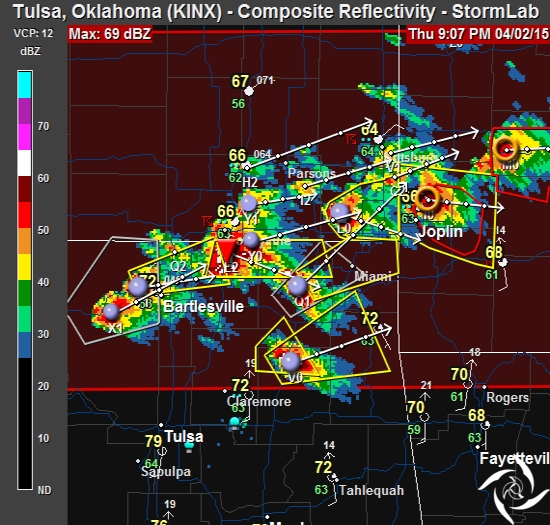
8:42 pm – Tornado Warning for Joplin, MO. I’m hoping for the best.

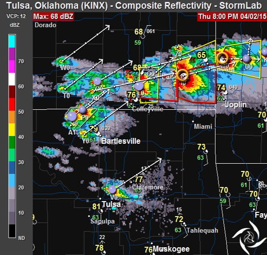
8:29 pm – Severe Thunderstorm Warnings are being issued for some counties in Oklahoma. One storm, NE of Tulsa.
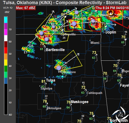
8:11 pm – storms are beginning to pop in Oklahoma. Most severe still north of the state line. Tornado Warnings have been issued in SE Kansas. Unfortunately this is all happening after sunset. Warning boxes suddenly started rendering.
7:48 PM – Watches/Warnings aren’t displaying on my radar. WTF? Reported it to Interwarn…they need to get that fixed! Could be a problem when the real chasing begins.
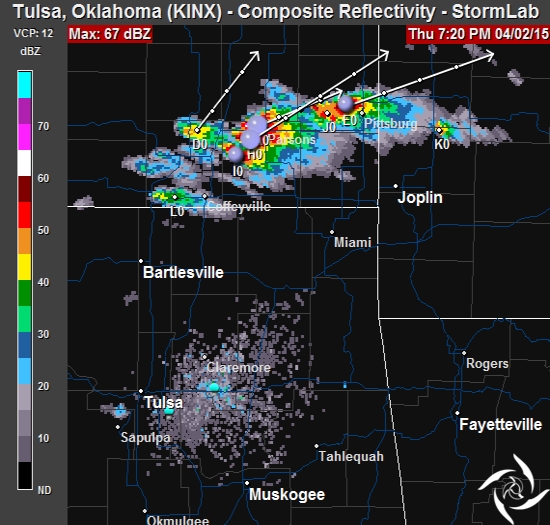
7:24 PM – Not much on radar in Tulsa, but in SE Kansas, it has blown up in the last few minutes.
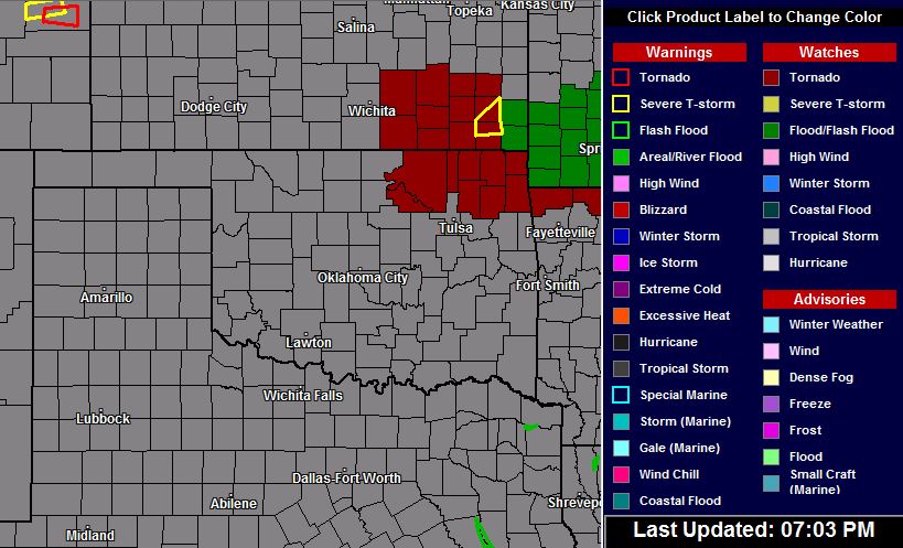
7:08PM – A Tornado Watch has been issued for some counties in NE Oklahoma. The watch is in effect until 2:00 am. Tulsa is not included at this time.
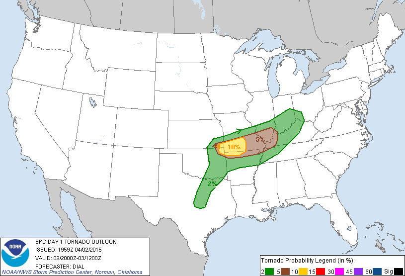
4:57 PM – I’m just now starting to look at the forecast and models for tonight’s severe weather potential. There’s no watches in effect right now, but it looks like a tornado watch could be issued for parts of NE Oklahoma shortly. The radar is pretty clear, but with local temps in the mid 80s and dew points in the 60s, anything is possible.
This is the latest tornado outlook for tonight. The risk isn’t great, but there is a risk. The greater risk (right now) is in far NE Oklahoma, but that doesn’t mean a tornado isn’t possible in the Tulsa area.
To be on the safe side, have your shelter-in-place plan ready to go. For now it’s a waiting game.