
5:25 PM
A Flash Flood Warning has been issued for several counties in NE Oklahoma, in effect until 1:30 AM Tuesday. We could see 1-2″ of rain per hour.
Includes: Adair, Benton, Carroll, Cherokee, Craig, Crawford, Creek, Delaware, Franklin, Madison, Mayes, Muskogee, Nowata, Okfuskee, Okmulgee, Osage, Ottawa, Pawnee, Rogers, Sebastian, Tulsa, Wagoner and Washington counties.
___
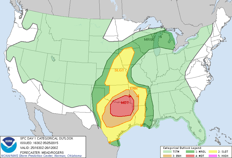
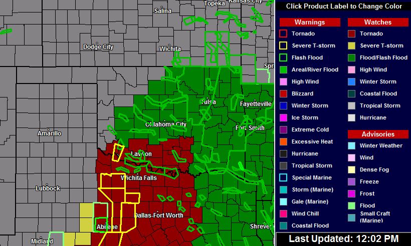
May 25, 2015, 12:05 PM
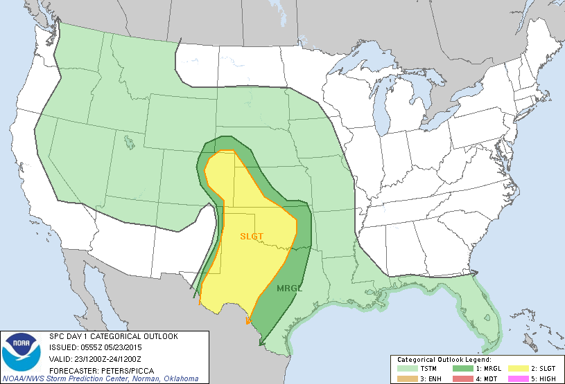
Another round of rain and severe storms is expected today here in Oklahoma. The severe weather is likely to stay south of Tulsa, but I wouldn’t bet my life on it. With this weather pattern, anything could happen. This is the latest SPC outlook for today.
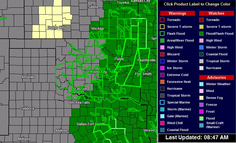
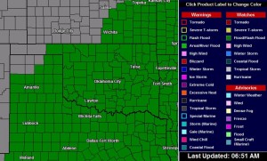
Watches and warnings are already being issued. Most of them are flood related.
I’ve looked at the situation all morning and decided to sit it out here in Tulsa. The road network in SE Oklahoma is terrible. With the potential of getting caught in a flash flood, plus severe weather, I’m not going to take the risk.
I’m becoming a “chicken”? No. I’m getting smarter!
___
May 24, 2015, 8:50 AM
There’s more than a few flood warnings in Oklahoma this morning. Just watched aerial footage of the flooding in Sapulpa. I hope Jared and his family are okay.
More rain to come.
___
8:45 pm
The National Weather Services has issued a Flash Flood Warning for Tulsa. In effect until 2:30 a.m. on Sunday.
___
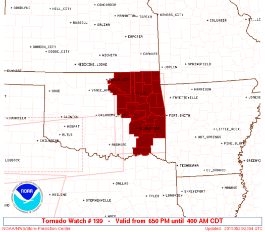
6:56 pm
The National Weather Service has issued Tornado Watch #199 for the Tulsa area and several counties in eastern Oklahoma. In effect until 4:00 a.m. on Sunday.
___
2:50 pm
It’s been relatively quiet in northeast Oklahoma, so far. A line of storms is developing now, moving up from the south towards Tulsa. That line should reach Tulsa within the hour. Nothing severe at this point.
___
6:43 am
I was hoping I’d have a chase opportunity today, but it’s looking more like a rain event. We could see 6-10 inches of rain over the next 3 days, which has prompted the National Weather Service to issue a Flash Flood Watch for much of Oklahoma. The ground is saturated and any additional rain will cause problems in some areas.
Showers and thunderstorms have already started to develop over the Oklahoma Panhandle and there’s a slight chance we’ll see the rain beginning this morning in northeast Oklahoma. The risk will increase after lunchtime across the area.
A risk of severe storms is possible too, although slight. This could change throughout the day as forecasts are updated.
If you have outdoor plans this weekend, stay weather aware. Flash flooding is likely in flood-prone areas. Streams, creeks and rivers could flood with little warning. Remember, if you encounter a water covered roadway, turn around. It doesn’t take a lot of water to ruin your day.