
8:15 PM
Rain will continue for a while, but the severe stuff has calmed down. No more updates, unless something changes.

6:30 PM
A Severe Thunderstorm Warning has been issued for the Tulsa area, effective until 7:15 PM.
The hazard is 60 MPH wind gusts.
6:15 PM
The rain has made it to the homestead. Coming down pretty good now. We’ll get a little break and then another, more powerful line of storms will move in.
6:03 PM
An urban and small stream flood advisory has been issued for Okmulgee, Osage, Pawnee, Washington, Creek and Tulsa counties. In effect until 9:00 PM.
Rain rates between 1 and 2 inches per hour are possible.
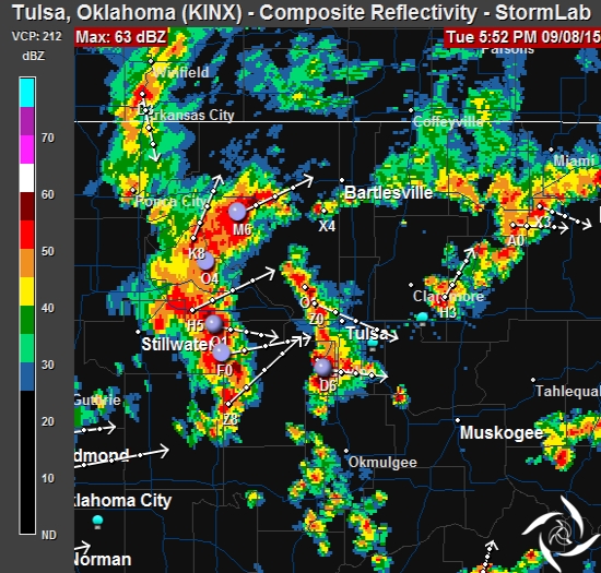
6:00 PM
Here’s the latest radar image.
5:42 PM
A Severe Thunderstorm Warning has been issued for portions of Creek and Tulsa counties in NE Oklahoma, effective until 6:30 PM.
Hazards include 60 MPH winds and half-dollar sized hail.
5:33 pm
A line of thunderstorms is moving into Tulsa. The greatest threat will be strong winds and hail. Significant Weather Advisories and Severe Thunderstorm warnings have been issued for counties to the west of Tulsa.
There’s no watches in effect at this time.
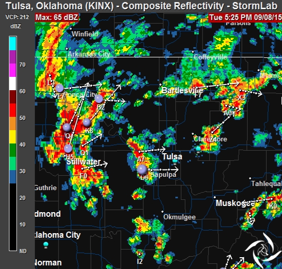 Thunderstorms are likely to continue through the evening and overnight hours.