
There’s been discussion the past couple days about the chance of severe weather moving into Oklahoma this week. We’re getting close enough to the event that I’m beginning to seriously look at the models and it appears we could have some major activity Tuesday evening in central and eastern Oklahoma.
The latest graphic from the National Weather Service shows an enhanced area – Tulsa is included. The setup could bring large supercell thunderstorms and tornadoes.
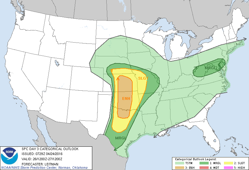
The model I’m looking at this evening shows the triple-point positioned in eastern Kansas on Tuesday, but if the cold air moves further south, the triple point could push south too, coming closer to Oklahoma and Tulsa.
Just in case, make sure your weather radio and flashlights have fresh batteries. It’s probably not a bad idea to get your shelter-in-place supplies and shelter area ready, too. If you wait until there’s a warning, it’s too late.
Keep in mind that this forecast could drastically change over the next couple of days, but it’s worth keeping an eye on.
I’ll post an update tomorrow night.