3/24/17, 7:15 AM Update
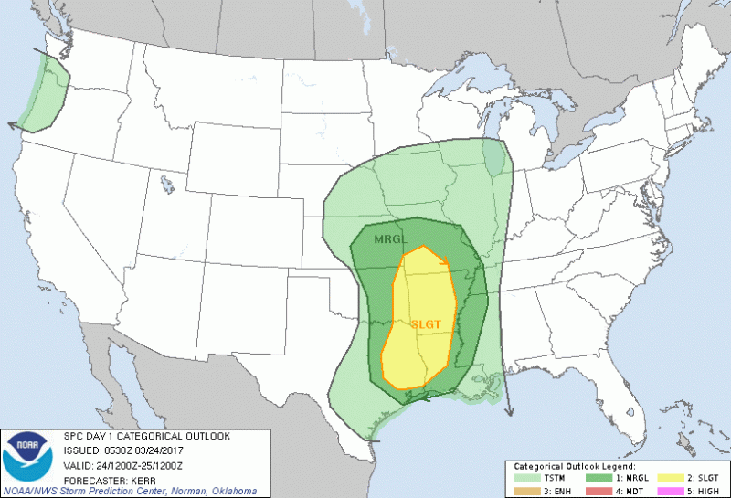
There’s not been much of a change, so far. A shift to the east puts Tulsa in the marginal area. SE Oklahoma is the likely target as of now. I’m not considering pulling out of Tulsa until the noontime models are released.
There’s a potential for severe weather on Friday, but storms will develop in the morning and could disrupt the pattern for afternoon storm development. This could be a bust for chasing on Friday. But, I’ll be watching the changes throughout today. My plan is still to chase, but we’ll have to play it by ear.
The greatest risk right now would be heavy rain, gusty winds and hail. However, we can’t rule our tornadoes.
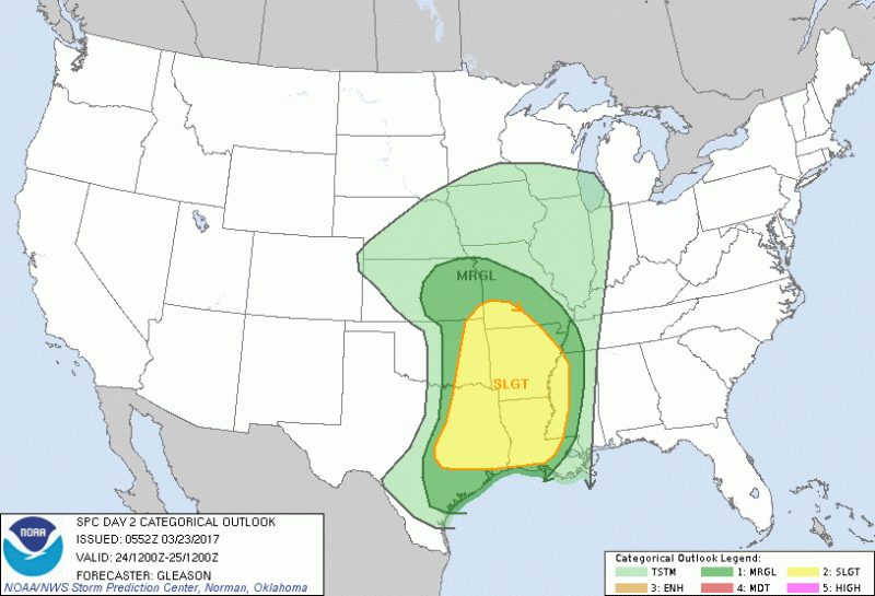
Here’s the SPC outlook graphic for tomorrow. Tulsa is on the edge of the slight risk area. A new graphic and outlook will be released in a couple of hours. I’ll update this post if anything changes.