When getting ready for a chase, I think the most difficult task is deciding where the best area for storm initiation will be. Rarely do two people agree on the same target. Major military conflicts have been waged over varying opinions about where to drive, how far to drive, and where the likely point of initiation will be. I try to keep things simple. I take some of what the forecast and model data is saying and combine that information with an extremely sensitive gut feeling and, of course, a little bit of luck doesn’t hurt.
On Friday morning, the models were indicating an elevated severe storm risk east of Tulsa and it looked like Little Rock was the target. I’ll have to be honest, the prospect of chasing storms in Arkansas didn’t appeal to me very much; if you’ve ever travelled through western Arkansas, you can probably imagine how difficult chasing storms there can be: the mountainous terrain and tall trees can block your line-of-site to a storm and, should you need to get out of an area quickly, the limited road networks provide few options for escape. It’s not an ideal situation for even the most seasoned chaser and those of us who have chased in Arkansas in the past understand the challenges and the dangers of chasing there.
Although the higher risk area was in the southern half of Arkansas, we decided to chase in the slight risk area of northwestern Missouri, to the south of Kansas City. Storms were developing in southern Nebraska and a tornado watch was issued for the area. A few higher profile chasers were hovering on the Kansas-Nebraska border.
At 1:30 in the afternoon we were on the road and heading north into Kansas.
At Iola, Kansas, we turned east towards the Missouri state line. Unfortunately, the storms weren’t developing like we’d hoped. We studied the models a little closer and scanned the latest forecasts and SPC discussions; the northern target wasn’t panning out. However, it did look like the original Arkansas target just might.
We turned south.
We’d driven a short time and Justin said there was a moderate risk of tornadoes in Mississippi. In fact, the NWS was predicting long tracking tornadoes for Saturday. We had to make a decision: go to Joplin and then head back to Tulsa or continue south towards Mississippi. At 6:00 the decision was made.
We were actually joking about the “long tracking” statement. In the past, whenever a forecast said “long tracking” we knew the chase was over. Those words seem to always kill a storm before it starts. Those are words I don’t really want to hear. I said, “This chase is over, we may as well go home.” We laughed, but we also stayed the course.
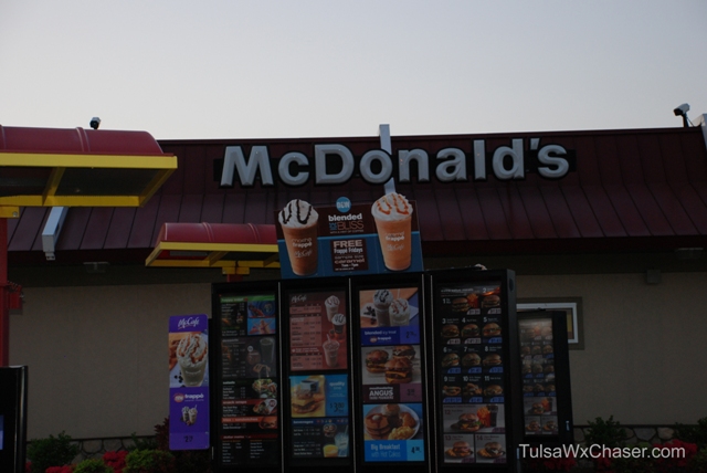
We stopped for coffee at a McDonald’s just before sunset and I shot what I thought at the time would be the only photograph of the trip — the McDonald’s sign. For my boss. Inside joke.
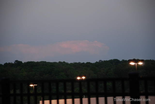
But, I did find a storm cloud, far off in the distance. Not a severe storm, but it was kind of pretty.
We continued on our journey, through Arkansas, through the mountains, through the trees, at night, in dense fog.
9:45pm, Ft. Smith, Arkansas.
2:22am, Texarkana, Texas.
4:03am, Shreveport, Louisiana.
We arrived in Monroe, Louisiana about 5:30am. We could travel no more. My eyes were burning and unable to focus. They wanted to close. We decided to get a little sleep in the truck. I remember leaning the seat back. Lights out. Justin claims he didn’t sleep. Whatever.
About 45 minutes after I’d dozed off, the alarms on the computers were going off. Tornado watches were being issued for Mississippi. Say what? In Oklahoma our severe weather usually happens in the late afternoon after things heat up a bit. Oh, right, we’re not in Oklahoma. Temps were already over 70° and the dew points were in the low 70s — thunderstorms were already developing.
After our short nap, a restroom break, more coffee and Zantac, we were back on the road. East to Vicksburg, Mississippi.
We arrived in Vicksburg just before 8:30 am. It doesn’t happen often, but the NWS issued a PDS (particularly dangerous situation) tornado watch for most of Mississippi. It looked like that long tracking dangerous tornado forecast might actually happen.
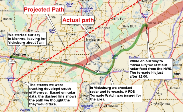
We stayed in Vicksburg for about an hour. I looked at the sky, Justin looked over the bulletins being issued. Occasionally I’d look at the radar watching a storm developing south of Monroe. The radar software shows the movement of the storm and the projected path of the storm. This one was going to go north-northeast.
We plotted our route and decided that Yazoo City would be a good place to sit and wait on the storm. Why Yazoo City? Because that city had east-west routes and north-south routes. From there, we could get behind the storm and chase it north and east.
We left for Yazoo City.
This graphic shows our route from Monroe to Vicksburg and then to Yazoo City. I’ve layed the projected and actual tornado paths onto the graphic so you can see how it worked out.
As many chasers today do, we put a lot of faith into our radar software and the ability to get to the internet. This fact isn’t necessarily a good thing. In the old days, we weren’t afforded such luxury. Back then, we depended on a road atlas, the radio weather reports and instinct. We’d soon find that past experiences would come in handy.
Along the way, we began having problems getting radar updates. Yes, an inconvenience, but we weren’t concerned. The last update we received projected the path of the storm well north of Yazoo City. We’d be on the backside of the storm. Right?
The following graphic will help me explain where the events happened as they unfolded.
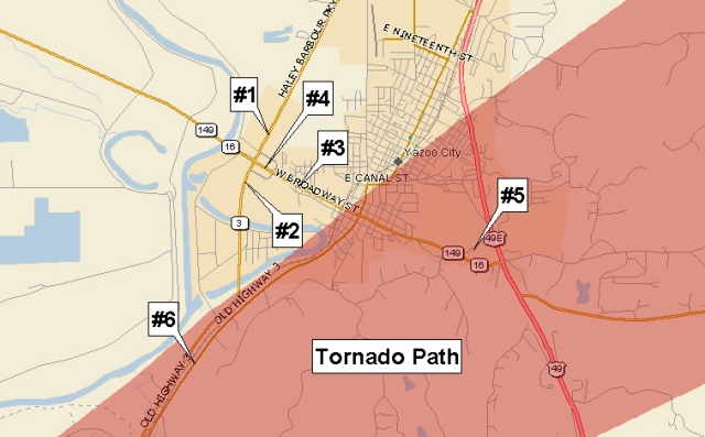
When we arrived in Yazoo City, we pulled to the shoulder of highway 3. (location #1). We were still having radar feed problems, but we got a good idea of what what about to happen when a woman stopped and told us a tornado had wiped out 30 houses in Eagle Bend, southwest of our location. We had no way of confirming exactly where the storm was now, but we were able to see the sky turning darker to the west and the clouds were becoming more threatening.
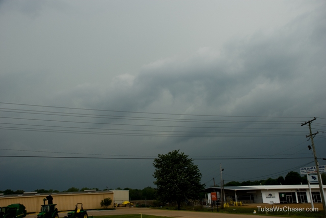
A few minutes later, we shared what we knew about the storm with the Emergency Manager. Within moments the tornado sirens were sounded; we were now under a tornado warning and the radar data was still not feeding as fast as we needed it to. We were flying blind. It was time to get into my “dirt sniffin'” mode and read the sky.
We moved south on highway 3 a couple of blocks to get a better look at the storm. (location #2). Without radar, we didn’t really know where the tornado was, but we could see that the storm was getting closer. The winds were changing. It was on our doorstep.
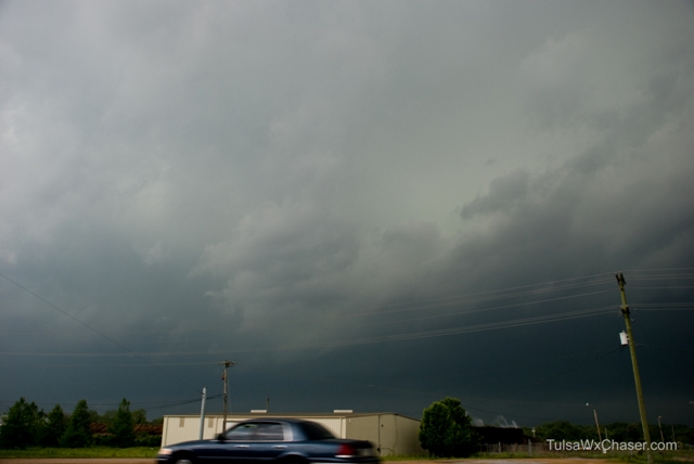
Earlier, the radar had indicated storm movement to the northeast. It was still moving to the northeast, but it was actually much farther south than we had initially projected. The storm was moving fast and it was heading right for us. The big question was: would it still go north of us or south of us. We had no choice but to wait and see where the worse part of the storm was located. In the photo below, you can see the storm to our southwest moving into Yazoo City.
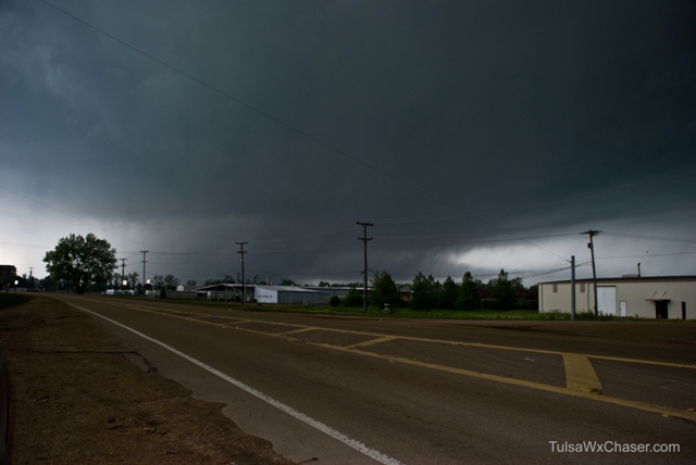
Just after 12:00 noon, the tornado hit.
We headed east into town, we looked to the south and there it was, a very large tornado had already begun causing damage. (location #3). Our escape to the east and to the south were both blocked by the tornado, so we turned around and went back west and attempted to use the overpass to cross over hwy 3. (location #4). Part way across the overpass we met driving horizontal rains and 80 mph winds. Visions of being hurled from the overpass to the highway below dominated my thoughts and proceeding west into who-knows-what wasn’t an option.
We quickly turned around and moved back to ground level on highway 3. The wind continued to blow, visibility was just a few feet and hail and debris pelted the truck. Motorists had congregated under the overpass we’d been on only seconds before blocking our exit to the north. We were trapped and the only thing we could do now was hope for the best and ride it out.
After the winds died down and the rain had stopped, we headed back into town. The debris field was city wide. Tree limbs and pieces of sheet metal littered the north side of town. As we drove east-southeast on Broadway, the damage path came into view. Buildings were heavily damaged and large trees had been uprooted. All signs of a powerful tornado.
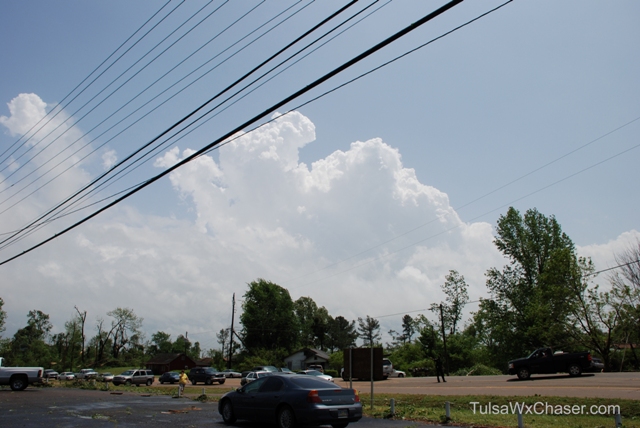
We were flagged down by a resident asking us if we had a pole saw. (location #5). A woman was trapped under a tree in a ditch behind the bait shop. We didn’t have a saw, but we stopped and offered our help anyway. Her son, visibily shaken by the ordeal, paced the small parking lot. He asked to use my cell phone to call his dad. He said his aunt was coming to pick him up. Emergency crews arrived and the woman was extricated from under the tree. She was transported in critical condition to the hospital.
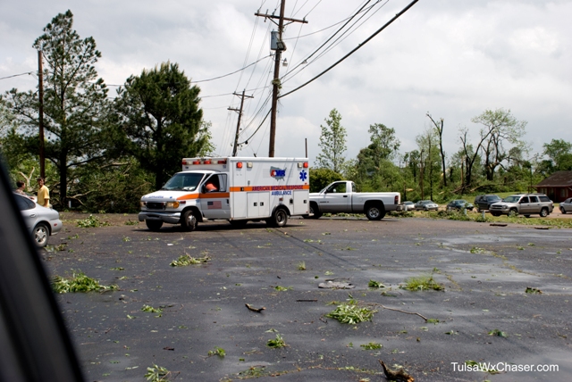
We realized there was little we could do to help and it was probably best to get out of the way. With the help of local law enforcement, we drove back towards the north side of town and to Highway 3 and then back south. We didn’t get far. Power lines were down and crossing the highway.
I called 9-1-1 to report the downed lines. The dispatcher asked us to block the roadway and divert traffic. We tried. Some people listened and turned around. Others braved the danger and proceeded around them. Once power trucks began arriving, we decided to call it a day and headed back north.
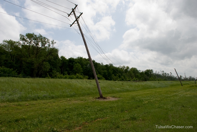
I think, for a while, Justin and I were both in a bit of shock. We drove for a while and began discussing what brought us to Yazoo City, what we could have done differently.
We arrived in Pine Bluff Arkansas and found a hotel. It’s located in the shopping mall. We hired a cab and went to dinner. Once back at the hotel, it didn’t take long for the effects of the long drive and the day’s events to take over and we were both sound asleep. This chase day was over.
We arrived back in Tulsa at 2:40 pm on Sunday. Our 3 day, 1,457 mile adventure took us through 7 states. We encountered one EF4 tornado and lived to tell the tale. It was good to be home.
