

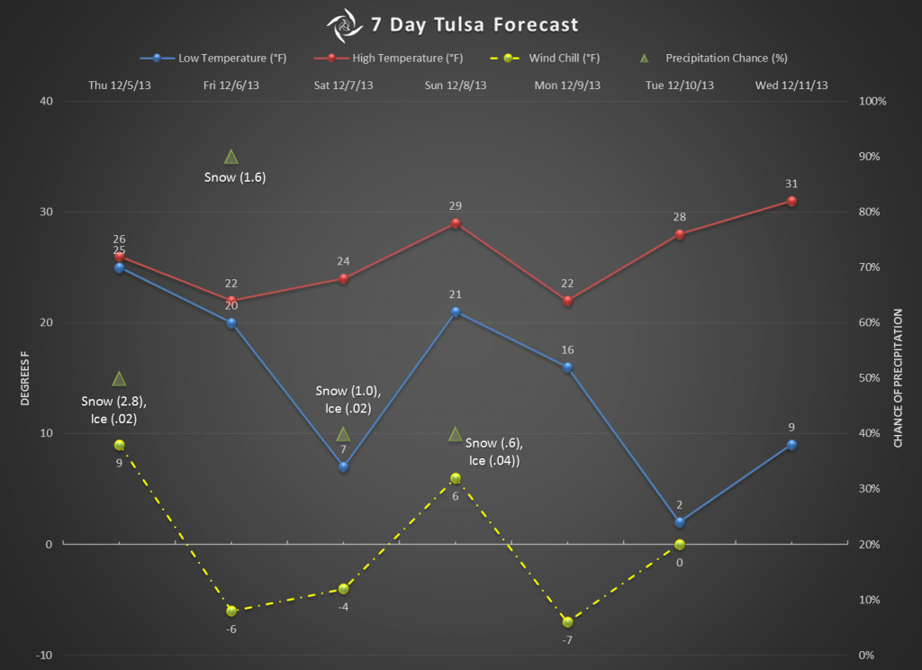
The forecast is being refined now and the timing is a little different than earlier forecasts were indicating. Now it looks like we’ll have LESS precip early Thursday morning and MORE precip tomorrow evening into the overnight hours. The risk for the morning is freezing rain and sleet. If that actually occurs, going to work could be a challenge. Friday morning is shaping up to be the morning we need to worry about.
I’m still seeing the potential of around 6″ total accumulation between Thursday and Sunday, with the majority of that happening on Thursday and Friday.
Very cold temperatures and wind chill values are a concern. Temps will only be in the 20s and wind chill values will likely be around zero or below for a few days.
I’d love to be able to tell you exactly how much snow and ice we’ll get. Unfortunately it’s a moving target. So, this will be one of those winter storms that we need to plan for the worse and hope for the best.
Hopefully we’ll have a better idea in the morning. If something changes, I’ll let you know.