
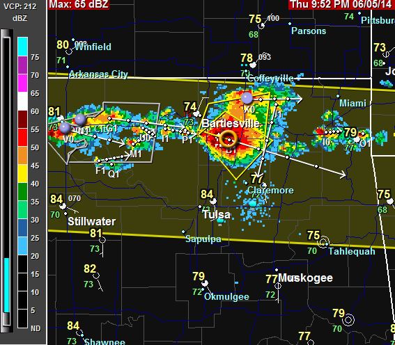
10:38 PM Tornado Warning issued for Osage and Pawnee counties in NE Oklahoma. Effective until 11:15PM.
10:16 PM Tornado Warning issued for WC Rogers, NE Tulsa, and S Washington counties in NE Oklahoma. Effective until 10:45PM.
9:59 PM Severe storm prompts a warning.
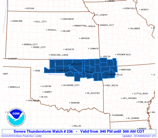
9:43PM Severe Thunderstorm Watch #236 in effect until 5 AM. Includes Tulsa.
9:00 PM It cleared off enough to see the moon.

8:42 PM Things quieted down today after the rain moved through. it was a little humid, but not too bad.
There’s another chance of rain overnight tonight and tomorrow.
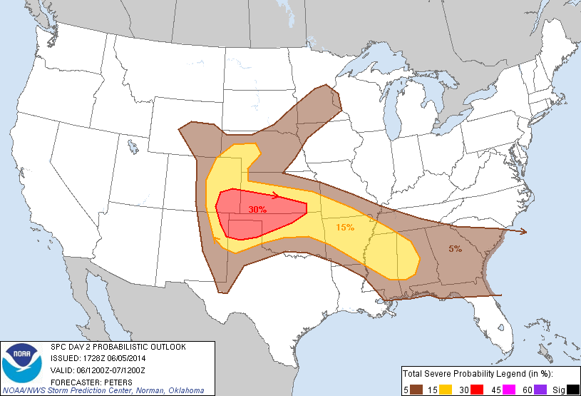
The SPC has issued a slight risk of severe storms tomorrow.
I’ll take a look again early tomorrow.
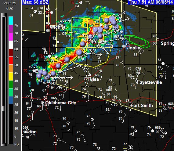
9:02 AM The line of thunderstorms made it to Tulsa. Heavy rain.
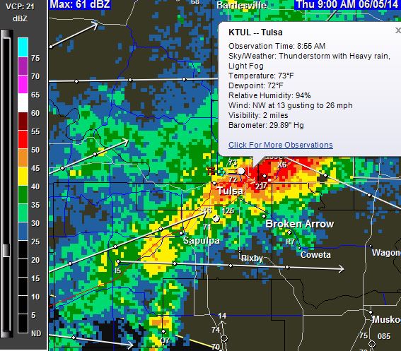
7:58 AM A line of thunderstorms is moving to the SE, towards Tulsa.
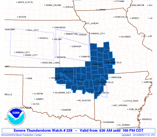
6:32 AM Severe Thunderstorm Watch issued for our area.
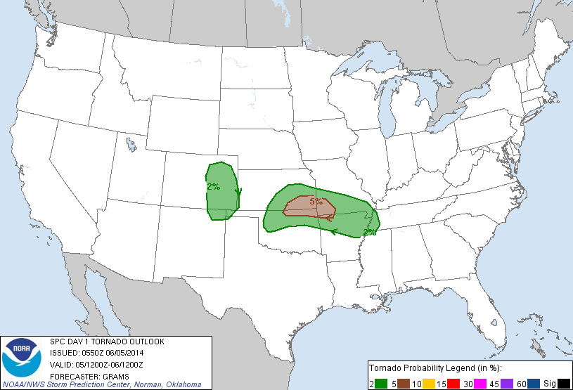
6:25 AM There’s a slight chance of severe weather in NE Oklahoma today. Major threat appears to be heavy rain, straight-line winds and hail. The most severe storms should stay to the north of Tulsa.
Tornadoes can’t be ruled out. The SPC has issued this graphic which shows the areas for tornado potential.
Stay weather aware.