
Sunday
6:12 pm
As you might have guessed, I didn’t venture to the west. The storms are just now beginning to develop west of OKC and it’s beginning to look like an “after dark” event. It would have been an awful long drive with a short chase window.
I’m going to continue tracking the storms here and begin looking at the storm possibilities for tomorrow.
For now…it’s finding something for dinner.
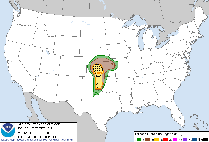
3:20 pm
A tornado watch was issued for western Oklahoma, effective until 9 pm. The dry line is still far west.

12:41 pm
I’m not saying I’m NOT going to chase today, but it’s not looking like it’d be worth getting out. They’ve tightened up the hot spots and south central Kansas, west of Wichita, and southwest Oklahoma are the areas of greatest concern. But, it’s not a great set-up.
I have a chase budget and I hate to waste the budget dollars to drive 4 hours for rain.
I’ll check again around 3. If things change, I’ll go. If they don’t, I won’t. I could always watch a movie and take a nap.
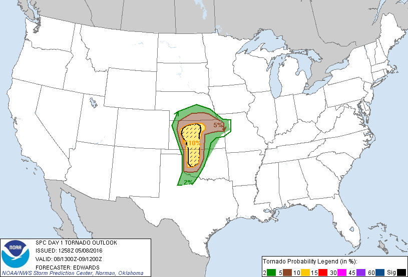
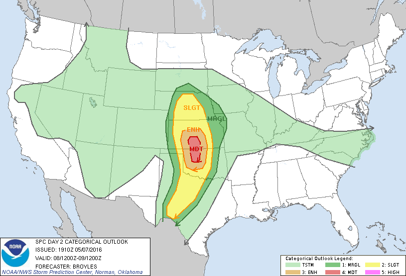
8:06am
The latest tornado outlook graphic. The area hasn’t changed a lot.
7:51 am
I’m not sure I like the setup enough to travel 3 hours to the projected hot-spot. The dry line is still way out in the panhandle and dew points aren’t high enough. Yet.
6:31am
We’re still looking at some boomers today. There’s no moderate risk area this morning, but that could be re-established as the day progresses. Highs today in the Tulsa area should top out at 80°. Chances of rain in our area with a slight risk of severe thunderstorms will continue through the day.
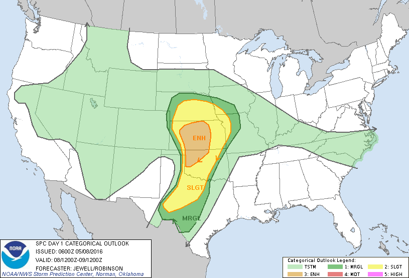
Saturday
11:30pm
I’ll look at this in the morning, but right now it looks like we could have some severe weather in Oklahoma tomorrow afternoon. Likely areas will be similar to the last chase – northwest/north central Oklahoma and south central Kansas. Basically around I-35, north of I-40.
This is the outlook graphic released earlier.
If this pans out, I may have a chase opportunity tomorrow.