
10/1 9:00 am update. The death toll from Ian has increased to over 30 and billions in damage was left behind. It will take some time for recovery.
Ian is now a post-tropical storm over N Carolina.
If you or your family have been affected by this storm, you are in my thoughts and prayers.
This is my last update for this storm. Stay safe and take care of each other.
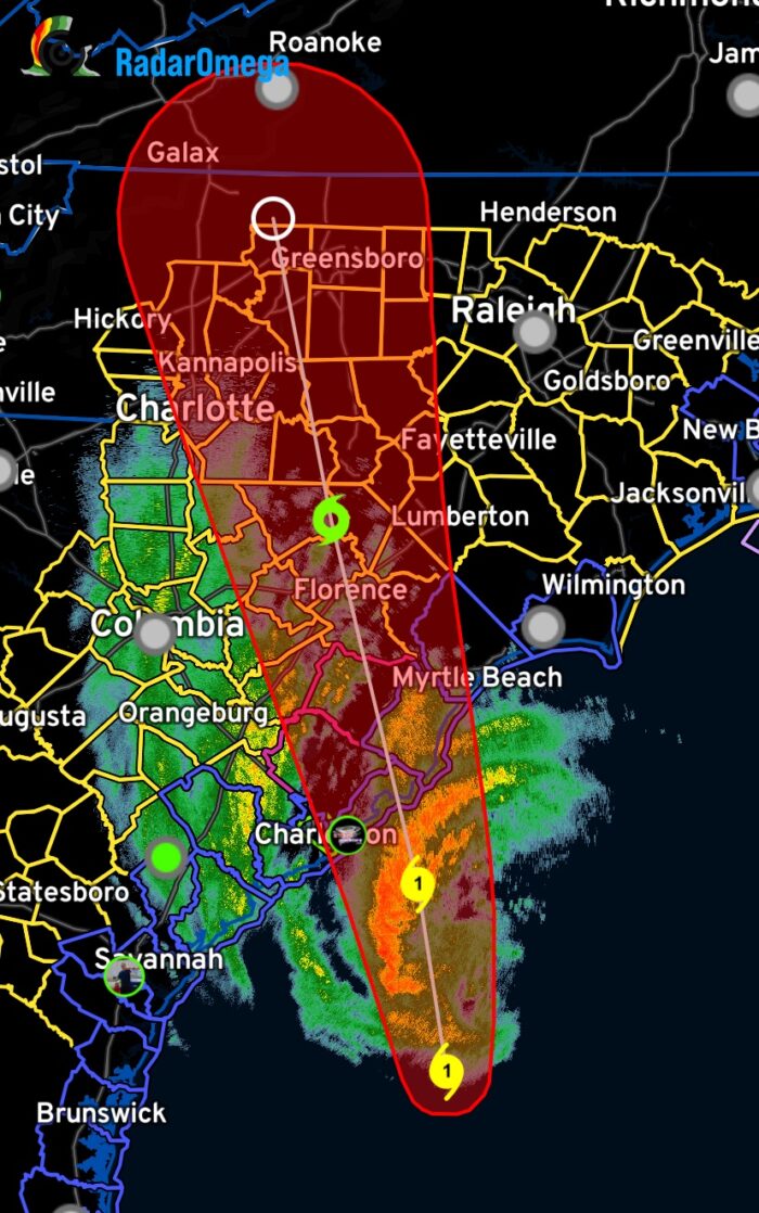
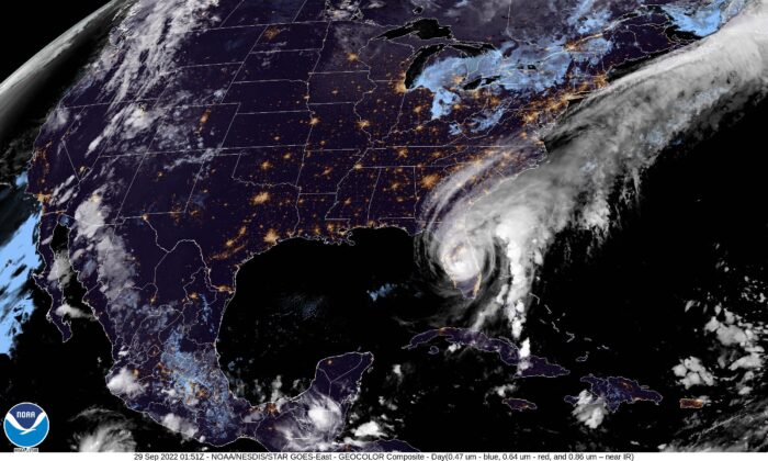
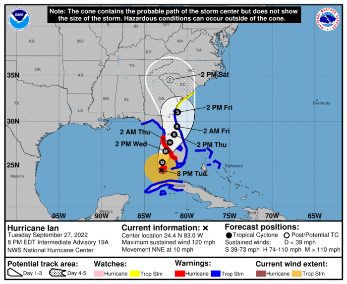
9/30 8:00 am update: Ian is once again a cat 1 hurricane with sustained winds of 85 mph. Expected to make landfall, for the third time, this afternoon, Ian is heading for McClellanville, SC, between Charleston and Myrtle Beach.
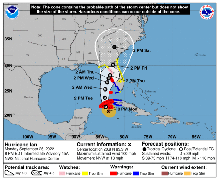
9/29 12:16 pm update: I thought I’d be done with this storm. It was expected to stay on land and weaken, then cleanup could begin. How wrong I was.
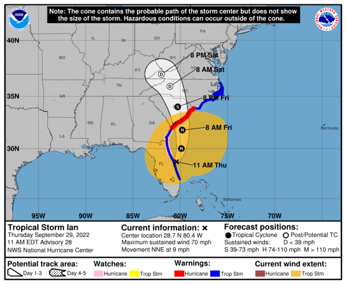
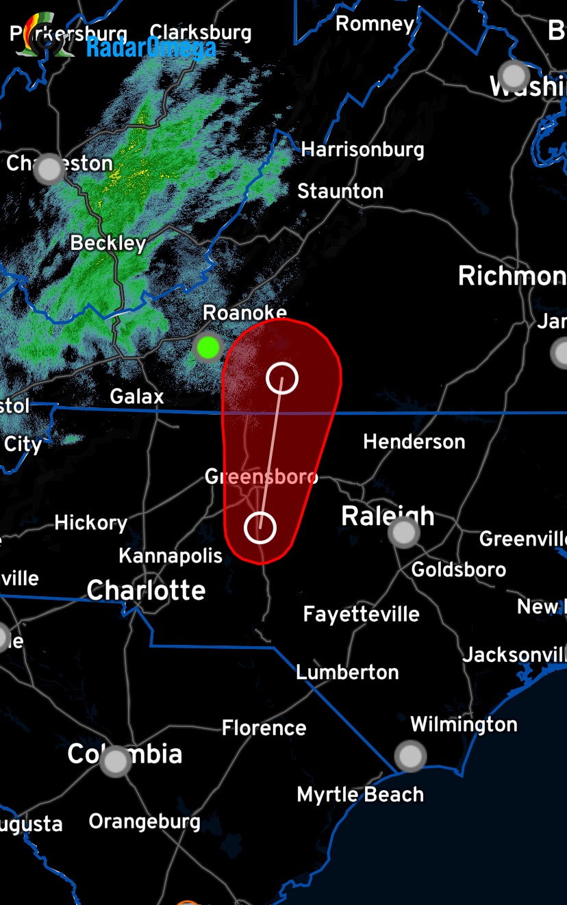
Ian is a tropical storm now with sustained winds of 70mph, but his path has changed and headed east back into the Atlantic. Because of this, the storm is once again growing.
The eye is re-developing now and it will likely become a category 1 hurricane before it makes landfall again in South Carolina.
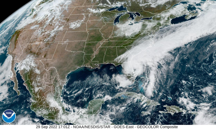
I guess we’ll be watching this one a little longer.
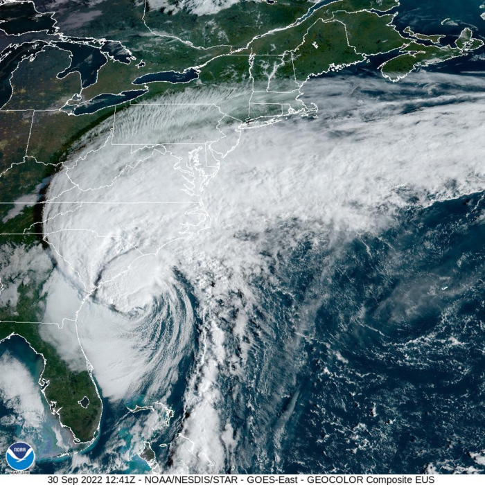
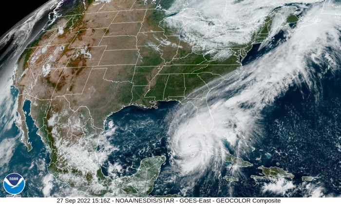
9:00 pm update: Ian moved inland this afternoon as a category 4, weakening after landfall to a category 2 now.
Over the next several hours, the storm will become a tropical storm as it moves north.
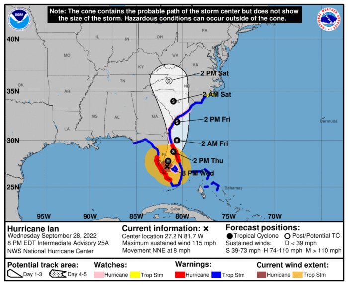
This will probably be my last update for Ian, unless something changes. Thanks for following along.
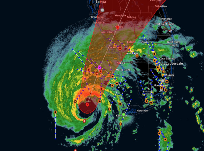
1:02 pm update: the eye of Ian is coming on shore north of Ft. Myers. still a category 4 hurricane with sustained winds of 155 mph and gusts to 190 mph.
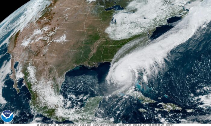
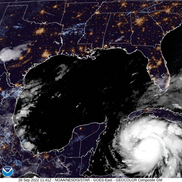
9/28 5:30 am update: Ian is now a category 4 with sustained wind speeds of 155mph. It’s still expected to make landfall this afternoon north of Cape Coral.
The total number of evacuations have surpassed 2M people along the coast.
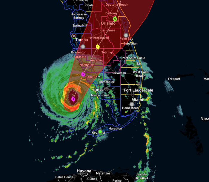
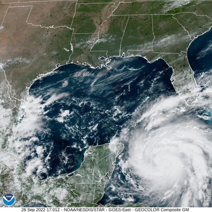
9:00 pm update: Ian continues to slowly move towards the coast of Florida. Landfall is expected tomorrow afternoon, but we could begin seeing impact to Florida overnight. As of now, it looks like the eye of the storm will move inland just north of Cape Coral as a category 4 hurricane with sustained wind speeds of 130-140 MPH.
Several tornadoes have developed in the outer bands of the storm and some damage has been reported. Tornado risk will continue for several days as Ian moves across Florida and north.

This is a slow-moving storm and major flooding, along with wind damage, is likely for a large portion of Florida. Mandatory evacuations continue along the coast, but that window is rapidly closing.
If you are in Florida, continue to monitor the situation in your area.
Talk soon.
9/27 10:34 am update: As the eye wall passes over Cuba, Ian is now a cat 3 hurricane.
9:54 pm update: Ian is now a category 2 hurricane with 100mph sustained winds as it approaches Cuba. It’s more organized. This storm is going to be devastating. Expected to grow to a category 4 prior to landing on the west coasts of Florida. 300,000 have been ordered to evacuate.
12:18 pm update: Ian will likely become a major hurricane. If you are on the west coast of Florida, be prepared to evacuate.
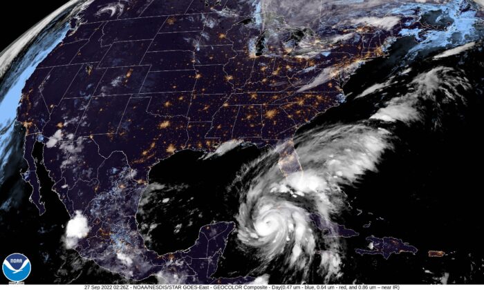
9/26 6:50 am update: Ian is now a hurricane – and it’s massive.
4:36pm update: Florida Governor DeSantis issued a State of Emergency ahead of the storm.
The next tropical storm is heading towards Florida and landfall is expected about the middle of next week. It looks like it’ll become a hurricane on Monday.
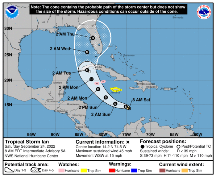
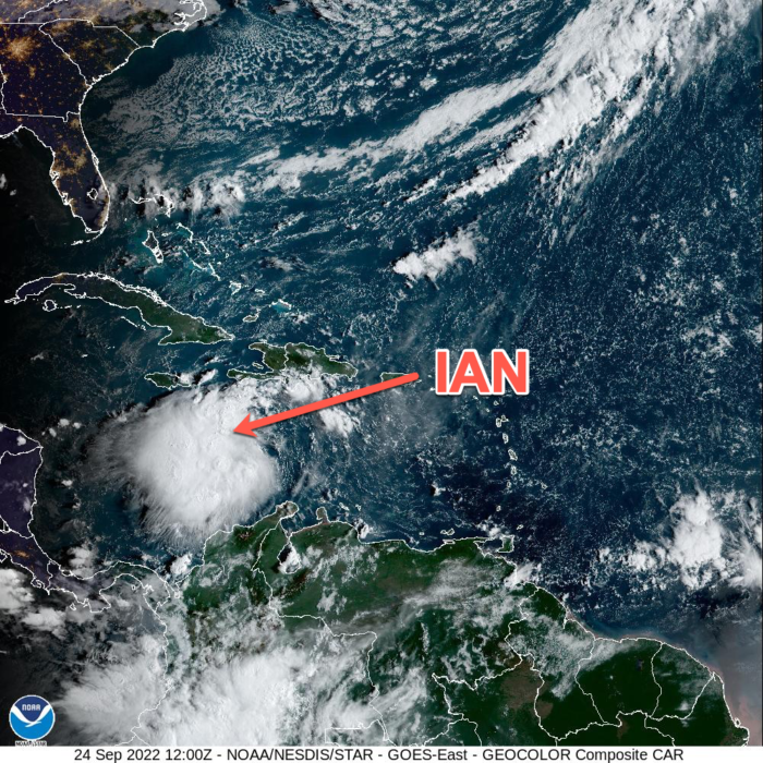
Now a tropical storm, Ian is already looking menacing.
I’ll keep an eye on this. Check back for updates.
Talk later.