
Monday, the morning after, update
I ended up going to bed when the line of storms was still in the OKC area. I looked for any signs of crazy weather in my area and found nothing. A couple of severe thunderstorm warnings near me, but that’s about all.
I was really looking forward to a good thunderstorm; great for sleeping. Not to say I didn’t sleep well.
Unfortunately, some folks around okc weren’t as lucky. Lots of damage. My prayers go out to those folks.
So, I’m considering this a non-event for Tulsa. A little disappointing, but that’s okay. Life goes on this morning. As you probably are, I’m heading to work this morning.
Until the next one.
8:10 pm update
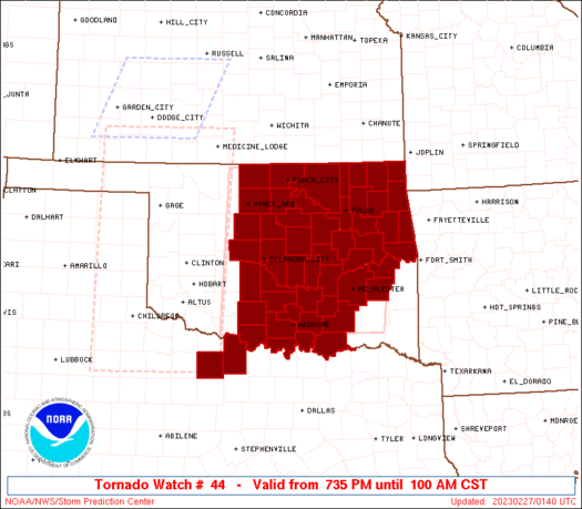
Storms have begun to fire in western Oklahoma now prompting tornado warnings being issued. It’s going to be a while before they reach my area. I’ll probably be in bed. We’re now under a tornado watch until 1 am. That means that almost ALL of Oklahoma are now under a tornado watch.
2:11 pm update
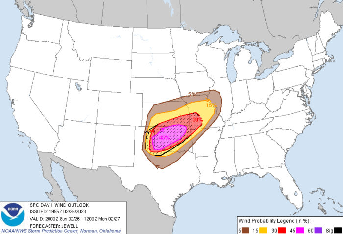
There’s been some talk about the potential for a derecho. That’s a long-lasting wind event. Wind speeds could be hurricane force of over 100mph. This could cause more damage than a tornado.
This is the latest wind outlook.
Tie down anything that could blow away.
11:33 am update
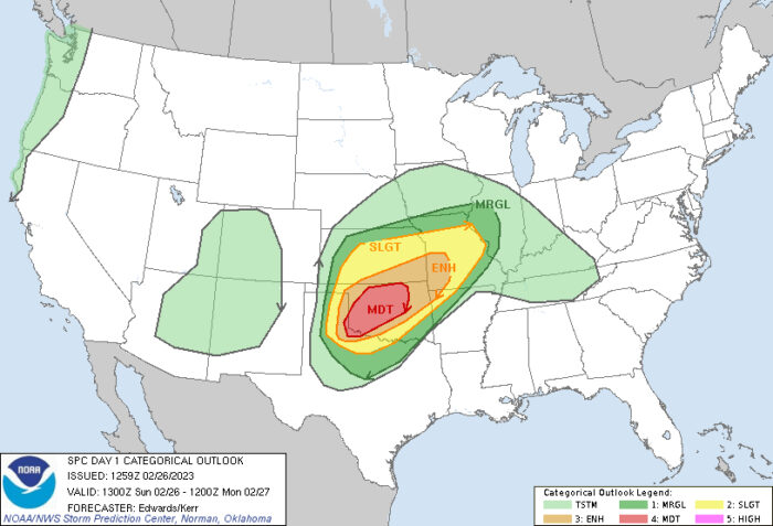
Well, as expected, the models are changing. The latest outlook graphics are showing widening areas of concern. Expect watches and warnings being issued for tonight.
I’m now in the moderate risk area. Crazy.
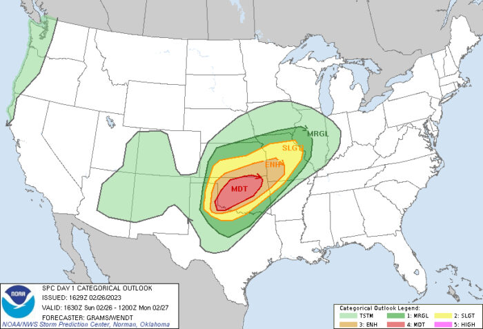
As well, the tornado risk areas have expanded some.
Here’s what the SPC is saying. Good info in this.
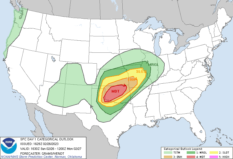
Well, it looks as though we will be getting some severe storms in Oklahoma today. Strong winds, heavy rain and tornadoes are possible. Fun times. I’m in the enhanced area, but the moderate area is sneaking closer.
I’m under a Wind Advisory already, but I doubt that’ll be the only bulletin we’ll receive today.
Watch the weather and get ready. It’s probably going to be a bumpy night.
Here’s the latest outlook for today. This is will ongoing today, but I think the worst of it will be after 6pm.
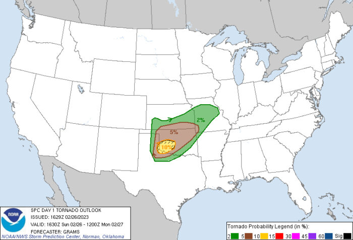
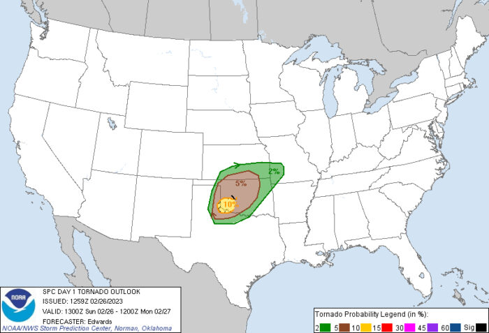
And this graphic shows the tornado potential. The highest risk area is in SW Oklahoma, but this will likely change through the day.k I’m in the 5% area.
I’ll update this as we get closer. I have a family thing this afternoon, but I should be back here around 5:00.
Talk soon.